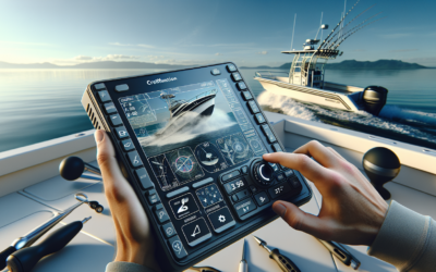
Imagine diving into the depths of the ocean, exploring the mysterious underwater world, and stumbling upon a hidden treasure in the form of a long-lost shipwreck. It sounds like a scene from an adventure movie, but with the help of fish finders, this fantasy can become a reality. These ingenious devices, typically used by anglers to locate schools of fish, are now being used by underwater explorers to discover shipwrecks lying silently beneath the surface. By harnessing the power of sonar technology, fish finders are revolutionizing the way we explore the depths of the ocean, providing us with a window into the past and unraveling the secrets of historical maritime disasters.
1. Understanding Fish Finders
1.1 How Fish Finders Work
Fish finders are invaluable tools for underwater exploration, specifically for locating shipwrecks. These devices utilize sonar technology to detect and display underwater objects, including fish and structures such as shipwrecks. The fish finder emits sound waves, which then bounce off objects in the water and return to the device, creating a visual representation on the screen. By interpreting these sonar images, you can identify potential shipwreck sites and navigate underwater with greater precision.
1.2 Types of Fish Finders
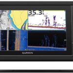
There are several types of fish finders available on the market, each with its own set of features and capabilities. The most common types include standalone fish finders, combination fish finders, and networked fish finders. Standalone fish finders are compact and portable, perfect for smaller watercraft or fishing enthusiasts. Combination fish finders incorporate additional features such as GPS and chart plotting, making them ideal for marine navigation. Networked fish finders allow for the integration of multiple devices, providing advanced networking capabilities and facilitating collaboration among underwater explorers.
1.3 Benefits of Using Fish Finders
Using fish finders offers numerous advantages when it comes to locating shipwrecks. Firstly, these devices greatly increase your chances of finding shipwrecks by providing real-time underwater imaging. Instead of relying solely on visual cues or historical records, fish finders allow you to explore underwater environments efficiently and effectively. Fish finders also enhance safety by providing information on underwater terrain, enabling you to navigate around potential hazards. Additionally, these tools help conserve valuable resources by optimizing exploration efforts and reducing the need for extensive manual searches.
1.4 Limitations of Fish Finders
While fish finders are incredibly useful for underwater exploration, it is essential to be aware of their limitations. One significant limitation is their reliance on sonar technology, which can be affected by various factors such as water clarity, depth, and structure density. Murky or turbid waters can hinder the accuracy of sonar imaging, making it more challenging to identify shipwreck sites. Additionally, smaller or highly fragmented shipwrecks may not produce distinct enough sonar returns, making them more difficult to detect. It is essential to understand these limitations and consider them when conducting underwater surveys using fish finders.
2. Basics of Underwater Exploration
2.1 Importance of Locating Shipwrecks
Locating shipwrecks holds significant historical, archaeological, and cultural value. Shipwrecks are windows into the past, providing insights into maritime history, trade routes, and seafaring traditions. By discovering and studying shipwrecks, we can gain a deeper understanding of our collective heritage. Moreover, shipwrecks often serve as artificial reefs, creating habitats that support a diverse range of marine life. By locating shipwrecks, we can not only preserve our history but also contribute to marine conservation efforts.
2.2 Challenges of Underwater Exploration
Underwater exploration is a complex and demanding endeavor. Explorers face numerous challenges, including navigating treacherous underwater terrains, dealing with limited visibility, and enduring harsh environmental conditions. The vastness and depth of the ocean make exploration a time-consuming and resource-intensive process. Furthermore, underwater exploration requires specialized equipment, extensive training, and collaboration among professionals from various disciplines such as archaeology, marine biology, and oceanography.
2.3 Tools and Techniques for Underwater Exploration
To overcome the challenges of underwater exploration, divers and researchers rely on a variety of tools and techniques. In addition to fish finders, other essential tools include remotely operated vehicles (ROVs), side-scan sonar systems, and underwater cameras. ROVs enable researchers to explore depths that are inaccessible to divers, capturing high-resolution images and videos of underwater environments. Side-scan sonar systems provide detailed sonar images of the ocean floor, helping locate potential shipwrecks. Underwater cameras allow for visual documentation and facilitate the study of marine life in shipwreck sites. These tools work in tandem to enhance our understanding of underwater environments and uncover hidden treasures.
3. Selecting the Right Fish Finder
3.1 Considerations for Choosing a Fish Finder
When selecting a fish finder for underwater exploration, several factors need to be considered. Firstly, consider the intended use and environment. Will you be primarily exploring shallow coastal waters or venturing into deeper offshore areas? Understanding your exploration needs and the types of underwater environments you’ll encounter will help determine the appropriate fish finder specifications. Additionally, consider factors such as screen size, resolution, and power output to ensure optimal performance and usability.
3.2 Key Features to Look for in a Fish Finder
To maximize the effectiveness of your fish finder for shipwreck exploration, certain key features are worth prioritizing. Look for fish finders with advanced sonar technologies, such as CHIRP (Compressed High-Intensity Radar Pulse), which provide superior target separation and clearer imaging. GPS and chart plotting capabilities are also important, as they allow for precise navigation and the creation of maps for future reference. Consider other features such as depth and temperature sensors, which can provide valuable information during underwater surveys.
3.3 Popular Fish Finder Brands
Several reputable brands offer fish finders that are well-suited for underwater exploration. Garmin, Lowrance, and Humminbird are among the leading manufacturers, known for their innovation and reliability. These brands offer a wide range of fish finders with various features and price points, catering to the needs of both recreational and professional underwater explorers. Researching and comparing the specifications and customer reviews of different brands and models will help you make an informed decision when selecting a fish finder.
4. Techniques for Locating Shipwrecks
4.1 Research and Historical Data
One of the first steps in locating shipwrecks is conducting comprehensive research and gathering historical data. Examining historical records, maritime archives, and navigational charts can provide valuable insights into potential shipwreck sites. Historical accounts of shipwrecks, trade routes, and maritime activities can narrow down search areas and guide further exploration efforts. Collaborating with historians, archaeologists, and local communities can help uncover hidden information and uncover previously unknown shipwreck sites.
4.2 Collaborating with Archaeologists and Divers
Collaboration with professionals in the fields of archaeology and diving is crucial for successful shipwreck exploration. Archaeologists can provide expertise in interpreting historical data and identifying potential shipwreck sites based on historical and cultural significance. Divers, on the other hand, play a crucial role in conducting underwater surveys and documenting shipwreck discoveries. By working together, professionals from different disciplines can combine their knowledge and skills to enhance the accuracy and effectiveness of shipwreck exploration efforts.
4.3 Understanding Ocean Currents and Tides
Ocean currents and tides play a significant role in the distribution and preservation of shipwrecks. Understanding the movement of ocean currents and the impact of tides is essential for locating shipwrecks. Currents can transport debris, artifacts, and sediments, potentially altering the location and distribution of shipwrecks over time. Analyzing historical data, consulting tidal charts, and leveraging oceanographic models can provide valuable information and guide the search for shipwrecks in specific areas.
4.4 Analyzing Sonar Imaging
Sonar imaging is a primary method for locating shipwrecks during underwater exploration. Analyzing sonar images requires a trained eye and a comprehensive understanding of shipwreck characteristics. Look for distinct anomalies in sonar returns, such as sharp edges, straight lines, or unnatural shapes, which can indicate potential shipwrecks. Pay attention to the depth of the seabed in relation to the size and shape of the sonar returns, as this can provide insights into the nature and magnitude of potential shipwreck sites. Collaborating with experts in shipwreck analysis can help refine your interpretation skills and improve the accuracy of your findings.
5. Analyzing Sonar Imaging
5.1 Interpreting Sonar Images
Interpreting sonar images requires a combination of knowledge, experience, and attention to detail. Sonar images provide valuable information about the underwater environment, including potential shipwreck sites. When analyzing sonar images, focus on identifying distinct features such as conical shapes, sharp edges, or unnatural patterns, which may indicate the presence of shipwrecks. Pay attention to variations in seabed depth and texture, as well as the density and orientation of sonar returns.
5.2 Identifying Potential Shipwreck Sites
Identifying potential shipwreck sites in sonar images involves a systematic approach. Look for anomalies that deviate significantly from the surrounding seabed. These anomalies may exhibit characteristics such as regular geometric shapes or clear outlines, indicating the presence of man-made structures like shipwrecks. It is important to cross-reference sonar images with historical data and existing knowledge of the area to validate potential shipwreck sites. Collaborating with experts in maritime archaeology and shipwreck analysis can enhance the accuracy and reliability of site identification.
5.3 Differentiating Shipwreck Targets from Natural Objects
Differentiating shipwreck targets from natural objects in sonar images can be a challenging task. Understanding the geological and biological features of the underwater environment is crucial in making accurate distinctions. Look for signs of distinct landmarks, structures, or cultural artifacts that are not commonly found in natural formations. Pay attention to the overall appearance and context of sonar returns to determine whether they are more likely to be associated with shipwrecks or natural features. It is essential to exercise caution and avoid premature assumptions, as misinterpretations can lead to inaccurate conclusions.
5.4 Depth and Size Estimations
Estimating the depth and size of potential shipwrecks based on sonar imaging requires careful analysis and measurement. By comparing the size and shape of sonar returns with known objects or referencing the scale provided by the fish finder, you can estimate the size of the potential shipwreck. Depth estimation involves assessing the distance between the seabed and the sonar returns, which indicates the vertical position of the shipwreck. Advanced fish finders often provide depth measurements directly, offering greater accuracy and reliability in determining the depth of potential shipwrecks.
6. Conducting Underwater Surveys
6.1 Preparing for the Survey
Before conducting an underwater survey, careful preparation is essential to ensure a successful expedition. Start by obtaining any necessary permits or permissions required for exploratory activities in the designated area. Prepare a detailed survey plan that includes specific objectives, sampling techniques, and safety protocols. Gather and pack all necessary equipment, including fish finders, diving gear, cameras, and documentation materials. Additionally, consider weather conditions, tides, and potential risks to ensure the safety of the survey team.
6.2 Using GPS and Navigational Tools
GPS and navigational tools are vital for accurate positioning and navigation during underwater surveys. Integrating a GPS system with your fish finder allows for precise tracking of important waypoints, shipwreck sites, and survey routes. This information can be logged and shared with the scientific community for future reference. Navigational tools such as compasses and depth gauges also provide essential data for plotting survey grids and assessing underwater topography. By utilizing these tools effectively, you can enhance the efficiency of your underwater surveys and improve the accuracy of your findings.
6.3 Dive Safety and Precautions
Safety should always be a top priority during underwater surveys. Proper training, certification, and equipment are essential for all divers involved. Conduct regular safety briefings, emphasizing the importance of following established protocols and maintaining effective communication. Consider employing the buddy system, where each diver is responsible for their partner’s safety and well-being. Ensure that all divers are equipped with appropriate safety gear, including dive suits, buoyancy control devices, and emergency breathing apparatus. Regularly assess and mitigate potential risks, such as strong currents, low visibility, or the presence of hazardous marine life.
6.4 Documenting Shipwreck Discoveries
Thorough documentation is vital for preserving and sharing shipwreck discoveries. As part of the survey team, document all findings, record data, and capture high-quality images and videos of shipwrecks and related artifacts. Take detailed measurements, note the shipwreck’s condition, and annotate any significant features or observations. Properly label and catalog any collected samples or artifacts for further analysis. Consider creating comprehensive reports and contributing to scientific databases or archives, ensuring that your discoveries can be accessed and studied by future generations of researchers and enthusiasts.
7. Challenges and Risks of Shipwreck Exploration
7.1 Salvage and Legal Considerations
One of the primary challenges in shipwreck exploration is navigating the legal and ethical considerations surrounding salvage operations. Shipwrecks often hold historical, cultural, and monetary value, leading to competing claims and controversies over ownership rights. Before engaging in salvage activities, it is essential to understand the legal frameworks and regulations that govern marine archaeological explorations. Collaborating with maritime legal experts can provide guidance and ensure compliance with relevant laws, preserving the integrity of shipwreck sites and minimizing disputes.
7.2 Conservation and Preservation Efforts
Preserving shipwreck sites and protecting their associated artifacts require careful conservation efforts. Exposure to the underwater environment, human activities, and natural degradation processes can lead to the deterioration of shipwrecks over time. Implementing conservation strategies, such as site stabilization and artifact restoration, is crucial for prolonging the lifespan of shipwrecks and maintaining their historical significance. Collaborate with conservation specialists and organizations to ensure appropriate measures are taken to protect and preserve shipwreck sites for future generations.
7.3 Safety Hazards and Risks for Divers
Shipwreck exploration poses inherent risks and hazards for divers. Challenging underwater conditions, such as strong currents, low visibility, and entanglement hazards, can pose significant dangers. Hazards posed by sharp metal edges, unstable structures, and potential remnants of cargo or fuel require divers to exercise caution and adhere to safety protocols. Proper training, regular equipment maintenance, and continuous communication are vital to minimize the risks associated with shipwreck exploration. Divers should always prioritize their safety and undergo appropriate training to mitigate and manage potential hazards effectively.
7.4 Environmental Impact
Shipwreck exploration can have environmental implications, both positive and negative. While shipwrecks can serve as artificial reefs and promote marine biodiversity by providing habitats for various species, they can also introduce potential pollutants and non-native invasive species. It is crucial to assess the potential environmental impact of shipwreck exploration activities and develop mitigation strategies to minimize negative effects. Engaging in environmentally responsible practices, such as properly disposing of waste and debris, adhering to no-touch policies, and avoiding sensitive ecological areas, is essential in protecting marine ecosystems.
8. Recording and Archiving Shipwreck Data
8.1 Importance of Data Collection and Documentation
Data collection and documentation are integral to the success of shipwreck exploration and scientific research. Accurate and comprehensive data allow for in-depth analysis, interpretation, and evaluation of shipwreck sites and associated artifacts. Thorough documentation ensures that the information gathered during underwater surveys is accessible and usable for future studies, comparisons, and further exploration. By adhering to standardized data collection methods and properly cataloging the information, you contribute to the scientific understanding of maritime history and support ongoing research efforts.
8.2 Using Geographical Information Systems (GIS)
Geographical Information Systems (GIS) play a crucial role in managing and analyzing shipwreck data. GIS allows for the integration of various types of geospatial data, facilitating the creation of detailed maps, visualizations, and models of shipwreck sites. By overlaying shipwreck locations with other relevant data, such as historical records, environmental conditions, and sociocultural information, GIS enables researchers to gain a deeper understanding of the contexts and interconnectedness of shipwreck sites. GIS also serves as a valuable tool for assessing the vulnerability and potential impacts of external factors on shipwreck preservation.
8.3 Creating Detailed Shipwreck Maps
Creating detailed maps of shipwreck sites is crucial for navigation, documentation, and further research. Utilize the data collected during underwater surveys, including GPS coordinates, sonar images, and visual observations, to create accurate maps and visual representations of shipwreck sites. Consider leveraging specialized mapping software or collaborating with cartographers and GIS specialists to enhance map accuracy and detail. Annotated maps that highlight specific features, artifacts, and areas of interest provide valuable references for future explorations and research endeavors.
8.4 Sharing Findings with the Scientific Community
Sharing shipwreck findings and contributing to the scientific community is essential for advancing knowledge and promoting collaboration in underwater exploration. Presenting research findings at conferences, seminars, or symposia allows researchers to exchange ideas, receive feedback, and inspire new avenues of study. Publishing research articles in scientific journals and contributing to relevant databases and archives ensure that your findings are accessible to the broader scientific and academic communities. By sharing your insights and discoveries, you contribute to the collective understanding and appreciation of underwater cultural heritage.
9. Future Advancements in Underwater Exploration
9.1 Technological Innovations in Fish Finders
The field of underwater exploration is constantly evolving, driven by technological advancements. Fish finders continue to improve in terms of features, performance, and ease of use. Technological innovations, such as higher-resolution displays, improved target separation, and enhanced networking capabilities, are being incorporated into fish finders. These advancements enable underwater explorers to gather more accurate and detailed information, enhancing their ability to locate shipwrecks and explore underwater environments.
9.2 Integration of Artificial Intelligence
Artificial Intelligence (AI) holds great potential in revolutionizing underwater exploration. AI algorithms can be trained to analyze sonar images, helping identify potential shipwreck sites more efficiently and accurately. By leveraging machine learning techniques, AI can learn from vast datasets of sonar returns and historical shipwreck records, improving its ability to differentiate between natural formations and man-made structures. The integration of AI into fish finders and exploration software can enhance the speed and accuracy of shipwreck identification, making underwater exploration more accessible and efficient.
9.3 Remote Sensing and Autonomous Vehicles
Remote sensing technologies, such as satellite imagery and airborne lidar, are increasingly being used to complement underwater exploration efforts. These technologies provide valuable insights into coastal features, water depths, and potential shipwreck locations. Autonomous underwater vehicles (AUVs) and remotely operated vehicles (ROVs) equipped with advanced imaging systems enable researchers to explore, map, and document shipwreck sites at greater depths and in more challenging underwater conditions. These advancements in remote sensing and autonomous vehicles expand the capabilities and reach of underwater exploration, paving the way for even more exciting discoveries.
9.4 Cultural and Educational Significance
The importance of shipwreck exploration extends beyond scientific and academic pursuits. Shipwrecks serve as unique cultural and educational resources, offering immersive learning opportunities and creating connections to the past. Future advancements in underwater exploration will undoubtedly foster increased public engagement and participation in shipwreck exploration. Virtual reality (VR) technologies, interactive exhibits, and educational programs can provide individuals with a firsthand experience of exploring shipwrecks, igniting curiosity, and fostering a sense of appreciation for our maritime history.
10. Conclusion
10.1 Summarizing the Benefits of Using Fish Finders
Fish finders have proven to be indispensable tools for locating shipwrecks during underwater exploration. These devices utilize sonar technology to provide real-time imaging of underwater environments, enhancing the efficiency and accuracy of shipwreck surveys. Fish finders increase the likelihood of finding shipwrecks, enhance navigational safety, and conserve valuable time and resources. By utilizing fish finders, underwater explorers can uncover hidden treasures, contribute to maritime archaeology, and gain a deeper understanding of our collective past.
10.2 Encouraging Responsible Shipwreck Exploration
As underwater exploration and shipwreck discovery continue to captivate explorers and researchers, it is crucial to encourage responsible exploration practices. Respecting the historical and cultural significance of shipwrecks, complying with legal frameworks, and working collaboratively with professionals from various disciplines are essential aspects of responsible shipwreck exploration. By prioritizing preservation, safety, and ethical considerations, we can ensure the long-term sustainability and integrity of shipwreck sites for future generations.
10.3 Exciting Discoveries Await with Fish Finders
The use of fish finders in underwater exploration opens up a world of possibilities and exciting discoveries. With each expedition, underwater explorers have the opportunity to unveil hidden stories, unravel mysteries of the past, and contribute to the scientific understanding of our maritime history. Fish finders, in conjunction with other advanced tools and techniques, enable us to approach shipwreck exploration with greater precision, efficiency, and safety. As technology continues to advance, the future of underwater exploration promises even more thrilling discoveries that will shape our understanding of the world beneath the sea.

