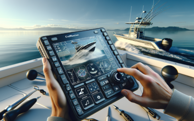
Imagine being able to explore the mysterious depths of the ocean, uncovering hidden treasures and discovering new underwater landscapes. Well, with the help of fish finders, this dream has become a reality for avid adventurers and fishing enthusiasts alike. Fish finders, typically used to locate fish, have now evolved to offer a unique feature – the ability to map and create custom underwater maps. In this article, we will delve into the world of mapping underwater landscapes with fish finders, exploring how this technology has revolutionized the way we navigate the depths and unlocking a whole new realm of possibilities for underwater exploration. So, grab your gear and get ready to dive into the incredible world beneath the surface!
Understanding Fish Finders
Fish finders are valuable tools for anglers who want to increase their chances of success on the water. These devices use sonar technology to locate underwater objects and provide information on fish presence, depth, and structure. By understanding how fish finders work and the different types available, you can choose the right one for your needs and improve your fishing experience.
How Fish Finders Work
Fish finders use sonar (sound navigation and ranging) technology to detect and display underwater objects. The device emits sound waves, which travel through the water and bounce off objects in their path. These reflected sound waves, or echoes, are then picked up by the fish finder’s transducer, which converts them into visual representations on the display screen. By interpreting these echoes, anglers can determine the depth, location, and size of fish, as well as underwater structures and other features.
Types of Fish Finders
There are three main types of fish finders: traditional sonar, side imaging sonar, and down imaging sonar. Traditional sonar provides a basic view of the underwater environment, showing the depth and location of fish and structures. Side imaging sonar uses a wider beam and provides a detailed side-to-side view of the underwater landscape, allowing anglers to identify fish and structures over a larger area. Down imaging sonar, on the other hand, provides a more detailed view directly beneath the boat, making it easier to identify and distinguish between fish and structures.
Choosing the Right Fish Finder
When choosing a fish finder, there are several factors to consider. The depth and size of the body of water you fish in, as well as the type of fishing you do, will influence the features and capabilities you need. Look for a fish finder that offers the right frequency range for your fishing environment, as higher frequencies are better for shallow water while lower frequencies are better for deep water. Consider the power and display resolution of the device, as well as any additional features like GPS and mapping capabilities, which can be beneficial for creating custom maps of underwater landscapes.
Benefits of Mapping Underwater Landscapes
Mapping underwater landscapes using fish finders can provide anglers with numerous benefits that can greatly improve their fishing success. By understanding these benefits, you can see the value in investing time and effort into mapping.
Improved Fishing Success
Mapping underwater landscapes can significantly improve your fishing success. By creating custom maps of fishing spots and identifying productive areas, you can focus your efforts on locations more likely to yield successful catches. These maps allow you to effectively plan your fishing trips, saving you time and increasing your chances of finding and catching fish.
Identifying Fish Habitats
Mapping underwater landscapes allows you to identify the habitats preferred by different fish species. By locating and marking these habitats on your custom maps, you can target specific species and adjust your fishing techniques accordingly. Whether it’s submerged vegetation, rocky structures, or deep holes, knowing where the fish are likely to be can help you maximize your fishing potential.
Locating Underwater Structures
Fish often gather around underwater structures, such as submerged trees, rock formations, or drop-offs. By mapping these structures, you can accurately mark their locations on your custom maps, ensuring you have a visual reference when you return to fish the area. This information can be invaluable in helping you navigate and position your boat, as well as identifying potential hotspots where fish are likely to congregate.
Preparing for Mapping
Before you begin mapping underwater landscapes, it’s essential to make the necessary preparations to ensure accurate and reliable results. This involves selecting the right mapping software, setting up your fish finder correctly, and calibrating and adjusting its settings for optimum performance.
Selecting the Right Mapping Software
To create custom maps, you’ll need mapping software compatible with your fish finder. There are various options available on the market, each offering different features and capabilities. Consider your specific needs and preferences when choosing mapping software, such as ease of use, compatibility with your fish finder model, and the ability to import and export maps. Some software also allows you to overlay your maps with satellite imagery for a more detailed view of the underwater landscape.
Setting Up Your Fish Finder
Properly setting up your fish finder is crucial to obtaining accurate mapping data. Begin by mounting the transducer correctly on your boat, ensuring it is positioned to provide the best possible sonar coverage. Next, connect the fish finder unit to a power source and mount the display screen in a convenient and easily visible location. Follow the manufacturer’s instructions for any additional components, such as GPS antennas or networking devices.
Calibrating and Adjusting Settings
Before starting the mapping process, it’s important to calibrate and adjust the settings of your fish finder for optimal performance. This includes adjusting the sensitivity, which determines how sensitive the device is to detecting echoes, as well as the frequency and cone angle settings. Experiment with different settings to find the optimal combination for the specific fishing conditions you’ll be encountering. Remember to refer to the manufacturer’s instructions for guidance on calibrating your specific fish finder model.
Mapping Techniques
Mapping underwater landscapes with fish finders involves using different sonar technologies to gather data and create detailed maps. Understanding the different mapping techniques can help you make the most of your fish finder’s capabilities.
Traditional Sonar Mapping
Traditional sonar mapping is the most basic and commonly used mapping technique. The fish finder emits a sound wave directly below the boat and displays the depth and presence of fish and structures in real-time. By slowly moving the boat across the water in a consistent pattern, you can create a detailed map of the underwater landscape. This technique is ideal for mapping smaller areas and provides a general overview of the surroundings.
Side Imaging Sonar Mapping
Side imaging sonar mapping provides a detailed side-to-side view of the underwater environment. The fish finder’s transducer emits a wider beam that sweeps across a larger area, allowing you to see a more extensive range. This mapping technique is useful for identifying fish and structures over a larger area and can provide a more comprehensive view of the underwater landscape.
Down Imaging Sonar Mapping
Down imaging sonar mapping focuses on providing a detailed view directly beneath the boat. The fish finder’s transducer emits a narrow beam that scans the area immediately below, capturing high-resolution images of the underwater structures and fish. This mapping technique is especially useful for identifying fish and structures in deeper water or when you want to focus on a specific area.
Interpreting the Data
Once you’ve gathered mapping data using your fish finder, it’s crucial to understand how to interpret the information displayed on the screen. This will allow you to make informed decisions while fishing and make the most of your custom maps.
Understanding Sonar Readings
Sonar readings displayed on your fish finder include depth, contours, and the presence of fish and structures. The depth readings indicate how deep the water is at a particular location. Contour lines represent underwater elevation changes, helping you identify drop-offs, ledges, and other structural features. Fish and structure icons on the screen indicate the presence of fish or underwater objects. Understanding what these readings mean and how they relate to the underwater landscape will help you navigate and fish more effectively.
Identifying Fish and Structures
Interpreting fish and structure readings on your fish finder’s display screen involves recognizing the different icons and patterns they represent. Fish icons typically appear as arches or clusters of dots, indicating the presence and approximate size of fish. Structure icons can represent submerged vegetation, rocks, or other underwater objects. By being familiar with these icons and patterns, you can quickly identify the fish and structures in your mapped areas, allowing you to target specific spots.
Analyzing Bottom Composition
Some advanced fish finders can provide information on the composition of the lake or river bottom. This data is useful for determining the type of bottom substrate, such as mud, sand, gravel, or rock. Certain fish species are more likely to inhabit specific bottom compositions, so knowing this information can help you target the right areas and adjust your fishing techniques accordingly.
Creating Custom Maps
Creating custom maps with your fish finder allows you to mark and save specific locations, customize the level of detail, and add additional information to enhance your fishing experience.
Using GPS Coordinates
Many fish finders are equipped with GPS capabilities, allowing you to mark and save specific locations using GPS coordinates. This feature enables you to return to the exact spots where you’ve had success in the past or explore new areas with confidence. By utilizing GPS coordinates, you can create accurate and reliable custom maps that will guide you to the best fishing spots time and again.
Creating Waypoints and Markers
Waypoints and markers are essential tools for customizing your maps. Waypoints are specific locations you want to mark for future reference, such as productive fishing spots or underwater structures. Markers allow you to highlight areas of interest, such as drop-offs, weed beds, or submerged trees. By adding waypoints and markers to your custom maps, you can create a visual representation of the underwater landscape, complete with important fishing information.
Adding Depth Contours
Depth contours provide valuable information about underwater topography and can be added to your custom maps. By overlaying depth contours, you can visualize changes in depth and underwater structures with greater accuracy. This information helps you understand the layout of the underwater landscape and identify potential fish-holding areas. When combined with GPS coordinates and waypoints, depth contours create comprehensive and detailed custom maps.
Navigating with Custom Maps
Once you’ve created custom maps with your fish finder, there are several ways to navigate and utilize them effectively, both on GPS devices and mobile apps.
Importing Maps to GPS Devices
If your fish finder has GPS capabilities, you can import your custom maps directly onto the device. This allows you to navigate and follow your maps in real-time while on the water. By utilizing the GPS functionality of your fish finder, you can accurately navigate to your marked waypoints, fishing spots, and underwater structures with ease.
Using Custom Maps on Mobile Apps
Many fish finders offer companion mobile apps that allow you to sync your custom maps and access them on your smartphone or tablet. These apps provide a convenient and portable way to navigate with your custom maps, even when you’re not on the water. You can plan your fishing trips, review your maps, and share them with other anglers directly from your mobile device.
Following Maps in Real-Time
Whether you’re using a GPS device or mobile app, following your custom maps in real-time is an excellent way to maximize your fishing success. By using the GPS functionality of your fish finder, you can navigate to specific waypoints and fishing spots accurately. This allows you to optimize your fishing efforts and make the most of the valuable information provided by your custom maps.
Additional Tools for Mapping
While fish finders are excellent tools for mapping underwater landscapes, there are additional tools and technologies that can enhance your mapping experience and provide even more detailed information.
Using Drones for Aerial Mapping
Drones equipped with high-quality cameras can capture aerial images of the water surface and shallow areas, providing a unique perspective of the underwater landscape. By combining these aerial images with your fish finder’s mapping data, you can create comprehensive maps that include above- and below-water features. The aerial mapping capability of drones allows you to explore larger areas and gain a better understanding of the underwater environment.
Utilizing Satellite Imagery
Satellite imagery can provide an additional layer of detail to your custom maps. By overlaying satellite images onto your fish finder’s mapping data, you can see a more realistic representation of the underwater landscape. This can be particularly useful for identifying submerged vegetation, reefs, or other features that may not be visible on traditional sonar or imaging sonar mapping. Combining satellite imagery with your fish finder’s data enhances the accuracy and visual appeal of your custom maps.
Combining Data from Multiple Sources
To create the most comprehensive and accurate custom maps, consider combining data from multiple sources. This can include data from different fish finders, mapping software, drones, or satellite imagery. By integrating data from various sources, you can obtain a more complete picture of the underwater landscape and increase your chances of locating fish and structures. Combining data also allows you to cross-reference and validate information, ensuring the reliability of your custom maps.
Tips for Accurate Mapping
To ensure accurate mapping results with your fish finder, there are several tips and techniques you can follow.
Maintaining Consistent Speed
When mapping with your fish finder, it is crucial to maintain a consistent speed throughout the process. Inconsistent speeds can lead to inaccurate readings and distorted maps. Use your boat’s speed control systems or manually maintain a steady speed to ensure the sonar readings and mapping data are reliable.
Avoiding Interference
Interference from other electronic devices or external factors can affect the performance of your fish finder and mapping accuracy. To minimize interference, consider using quality shielding cables, keeping other electronics away from the fish finder’s transducer, and ensuring the transducer is installed correctly. Additionally, be aware of potential sources of interference, such as nearby boats or structures, and adjust your settings accordingly.
Understanding Mapping Limitations
While fish finders are powerful tools, they do have limitations when it comes to mapping underwater landscapes. Factors such as water clarity, depth, and bottom composition can affect the quality of the sonar readings and the accuracy of the maps. It’s important to understand and consider these limitations when interpreting the data and planning your fishing trips. Continuously calibrating and adjusting the settings of your fish finder can help mitigate some of these challenges and improve the accuracy of your maps.
Future Developments in Mapping
As technology continues to advance, the future of mapping underwater landscapes looks promising. There are several exciting developments on the horizon that will further enhance the capabilities and effectiveness of fish finders and mapping tools.
Advancements in Imaging Technology
Advancements in imaging technology are continually improving the quality and resolution of fish finder displays. High-definition and ultra-high-definition screens provide clearer, more detailed images of underwater environments, allowing anglers to interpret data with greater accuracy. The development of enhanced imaging techniques, such as 3D imaging and augmented reality overlays, may revolutionize the way anglers map and navigate underwater landscapes.
Artificial Intelligence in Mapping
Artificial intelligence (AI) has the potential to significantly enhance mapping capabilities. By leveraging AI algorithms and machine learning, fish finders can automatically identify and tag fish species, underwater structures, and other features. AI-powered fish finders can learn from previous mapping data to provide more accurate and precise sonar readings. This technology has the potential to revolutionize the way anglers interpret mapping data and optimize their fishing strategies.
Crowdsourced Mapping Data
The ability to share and access crowdsourced mapping data has the potential to benefit anglers worldwide. By collectively contributing mapping data to a central database, anglers can access a vast repository of custom maps and shared knowledge. This shared data can provide valuable insights into fishing spots, habitats, and underwater structures, enabling anglers to make more informed decisions and improve their fishing success. The future of crowdsourced mapping data holds immense potential for the angling community.
In conclusion, mapping underwater landscapes with fish finders is an invaluable tool for anglers looking to improve their fishing success. By understanding how fish finders work, the different types available, and the benefits of mapping, you can make informed decisions when choosing a fish finder and maximize its capabilities. Preparing for mapping, using the right techniques, and interpreting the data correctly will ensure accurate and reliable custom maps. By utilizing these maps while navigating and fishing, you can enhance your fishing experience and increase your chances of success. With the advancements in mapping technology and the potential for future developments, the future of mapping underwater landscapes looks exciting, promising even greater opportunities for anglers.

