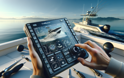
Imagine exploring the depths of the ocean, with its mysterious and unseen wonders. Have you ever wondered how we are able to discover what lies beneath the surface? Fish finders are the key to unlocking the secrets of underwater structures and terrain, going beyond simply locating fish. In this article, we will explore the fascinating world of fish finders and their role in uncovering the hidden mysteries of the underwater world. Get ready to dive in and discover a whole new perspective on the ocean!
Overview
Fish finders are not just tools to help you locate fish, but they also have the capability to locate underwater structures and terrain. The principle of operation of fish finders involves the use of sonar technology to detect and display objects below the surface of the water. There are different types of fish finders available in the market, each offering unique features and capabilities. Advancements in fish finder technology have made them more efficient and accurate in locating underwater structures and terrain.
Understanding Fish Finders
Principle of Operation
Fish finders work on the principle of sonar technology, which stands for Sound Navigation and Ranging. The fish finder emits sound waves or sonar signals through a transducer into the water. These sound waves travel through the water and bounce back when they encounter an object. The transducer receives these echoes and converts them into electrical signals. The fish finder then processes these signals to display the location, depth, and size of the objects detected.
Types of Fish Finders
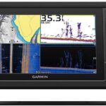
There are various types of fish finders available in the market, each designed for specific purposes. Traditional fish finders use a single frequency sonar and are suitable for shallow water fishing. Combination fish finders, on the other hand, combine traditional sonar with advanced features like GPS and chartplotting. They are versatile and can be used in various fishing environments. Finally, there are advanced fish finders with features like side-scan and down-scan imaging, which provide detailed images of the underwater structures and terrain.
Advancements in Fish Finder Technology
Fish finder technology has come a long way, making significant advancements over the years. Modern fish finders are equipped with high-definition displays that offer clear and detailed images of the underwater environment. The integration of GPS technology has made it easier for anglers to navigate and mark their favorite fishing spots. Moreover, the availability of side-scan and down-scan imaging has revolutionized the way underwater structures and terrain are detected and mapped.
Locating Underwater Structures and Terrain
Importance of Locating Underwater Structures and Terrain
Locating underwater structures and terrain is crucial for various reasons. It helps anglers identify potential fishing hotspots where fish tend to gather and hide. Understanding the underwater topography allows anglers to navigate safely and avoid hidden obstacles. Additionally, locating structures like submerged rocks, reefs, and drop-offs can help anglers understand the fish’s behavior and preferred habitats.
Identifying Structures and Terrain with Fish Finders
Fish finders play a vital role in identifying underwater structures and terrain. By using sonar technology, fish finders can detect and display objects such as rocks, reefs, submerged vegetation, and even the contour of the seabed. These features are accurately represented on the fish finder’s display, allowing anglers to visualize the underwater environment and make informed decisions about where to fish.
Sonar Imaging for Structure and Terrain Detection
Modern fish finders equipped with side-scan and down-scan imaging technology provide detailed images of underwater structures and terrain. Side-scan imaging uses a wide beam to create a visual representation of the area to the sides of the boat. This allows anglers to see objects and structures that are not directly beneath them. Down-scan imaging, on the other hand, provides a detailed view directly beneath the boat, making it easy to spot obstacles and underwater features.
Mapping Underwater Structures and Terrain
Benefits of Mapping Underwater Structures and Terrain
Mapping underwater structures and terrain offers several benefits for anglers and boaters. By creating detailed maps, anglers can revisit their favorite fishing spots with accuracy. Mapping helps anglers understand the patterns and movements of fish in relation to underwater structures. It also allows them to identify potential areas where fish may be located, saving time and effort on the water.
Techniques for Mapping with Fish Finders
Fish finders can be utilized to map underwater structures and terrain efficiently. By using GPS and chartplotting capabilities, anglers can mark and save locations of interest directly on the fish finder. By slowly cruising over an area, anglers can create a detailed map of the seabed, including structures, depth contours, and vegetation. These maps can then be used to navigate, revisit productive fishing areas, and share information with other anglers.
Creating Detailed Maps with Fish Finder Data
To create detailed maps with fish finder data, anglers can utilize software programs specifically designed for mapping purposes. These programs allow anglers to upload their fish finder data and create detailed maps with accurate underwater structure representations. The maps can be customized with different overlays, such as depth contours, vegetation, and different colors to indicate variations in underwater features. These detailed maps provide valuable information for anglers to plan their fishing trips and maximize their productivity.
Navigating Around Underwater Obstacles
Detecting and Avoiding Underwater Obstacles
Navigating safely in the water requires the ability to detect and avoid underwater obstacles. Fish finders equipped with advanced sonar technology can help in this regard. By using side-scan and down-scan imaging, anglers can identify submerged rocks, logs, or other obstacles that may pose a danger to their boat. The real-time display on the fish finder allows anglers to navigate around these obstacles safely and avoid potential damage to their vessel.
Utilizing GPS with Fish Finders
GPS technology integrated into fish finders offers additional navigation assistance. By utilizing GPS, anglers can mark and save the locations of underwater obstacles they encounter. These marked locations can serve as waypoints to navigate around obstacles in subsequent trips. GPS also provides accurate positioning information, making it easier for anglers to navigate and stay on course.
Real-Time Navigation Assistance
Fish finders equipped with GPS and chartplotting features provide real-time navigation assistance. These features allow anglers to plot their course, set waypoints, and navigate to specific locations with ease. The real-time display on the fish finder shows the boat’s position in relation to the marked waypoints and obstacles, ensuring safe and efficient navigation on the water.
Enhancing Fishing Success
Understanding Fish Behavior and Habitats
To enhance fishing success, it is essential to understand fish behavior and their preferred habitats. Fish finders can provide valuable insights into these aspects. By locating underwater structures and terrain, anglers can identify the areas where fish tend to congregate. They can also observe how fish relate to different structures and determine their preferred habitats. Understanding these patterns can significantly improve the chances of a successful fishing trip.
Pinpointing Prime Fishing Spots
Fish finders enable anglers to pinpoint prime fishing spots with precision. By analyzing the data displayed on the fish finder, anglers can identify areas with promising underwater structures such as reefs, drop-offs, or submerged vegetation. These areas are likely to attract fish and provide excellent fishing opportunities. By marking these spots and revisiting them in the future, anglers increase their chances of consistently catching fish.
Optimizing Fishing Technique with Fish Finder Data
Fish finder data can be utilized to optimize fishing techniques and strategies. By understanding the depth at which fish are located, anglers can adjust their fishing gear and bait presentation accordingly. They can also identify areas with fish schools, allowing them to target larger numbers of fish. Fish finder data provides real-time information about fish presence and behavior, enabling anglers to adapt their fishing techniques for maximum success.
Expanding Applications Beyond Fishing
Scientific Research and Exploration
Fish finders have applications beyond recreational fishing. They are widely used in scientific research and exploration of marine environments. Scientists and researchers can utilize fish finders to study fish behavior, migration patterns, and population dynamics. The ability to locate underwater structures and terrain helps in understanding habitat preferences and mapping important ecosystems.
Marine Life Conservation and Habitat Assessment
The information provided by fish finders can greatly contribute to marine life conservation and habitat assessment efforts. By identifying critical habitats and mapping underwater structures, conservationists can understand the impact of human activities on marine ecosystems. This knowledge enables them to take appropriate measures to protect and preserve these habitats for future generations.
Underwater Construction and Infrastructure Projects
Fish finders also find applications in underwater construction and infrastructure projects. By accurately mapping underwater structures and terrain, engineers and construction teams can plan and execute projects more efficiently. Locating potential obstacles and understanding the underwater topography helps in making informed decisions and ensuring the safety and success of these projects.
Tips for Efficient Use of Fish Finders
Understanding Fish Finder Settings
To make the most of your fish finder, it is crucial to understand and adjust the settings for optimal performance. Familiarize yourself with the different display modes, sensitivity settings, and frequency options. Experiment with these settings to find the best combination for your fishing environment. Additionally, understanding how to interpret and adjust the sonar readings will enhance your ability to locate fish and underwater structures accurately.
Interpreting Sonar Readings
Being able to interpret sonar readings is essential for efficient use of fish finders. Different objects and structures in the water will appear differently on the fish finder’s display. Learn to differentiate between fish arches, vegetation, and other underwater features. Take note of the depth and size of the objects detected to gain a better understanding of the underwater environment.
Mastering Depth and Range Controls
Mastering depth and range controls on your fish finder is crucial for accurate detection and mapping of underwater structures and terrain. Adjust the depth range setting to match the water depth you are fishing in. This ensures that the fish finder displays the structures and fish at the appropriate depth for optimal visibility. Similarly, adjust the range control to focus on the specific area you want to map or locate fish in.
Choosing the Right Fish Finder
Considerations for Different Fishing Environments
When choosing a fish finder, consider the fishing environment you will most frequently encounter. If you primarily fish in shallow waters such as lakes or rivers, a traditional fish finder with basic features may suffice. However, if you venture into deeper waters or coastal areas, a combination fish finder with GPS and chartplotting capabilities would be more suitable. Evaluate your fishing needs and preferences before making a decision.
Features to Look for in a Fish Finder
There are several features to consider when choosing a fish finder. Look for a high-resolution display that provides clear and detailed images of the underwater environment. Consider the power and frequency options, as higher frequencies are better for shallow waters, while lower frequencies penetrate deeper waters. GPS and chartplotting features can greatly enhance your fishing and navigation experience. Finally, ensure the fish finder is durable and waterproof to withstand the rigors of fishing.
Budget and Cost Considerations
Consider your budget when selecting a fish finder. Prices vary based on the features and capabilities of the fish finder. Determine the essential features you need and prioritize them accordingly. While advanced fish finders with cutting-edge technology may offer more functionalities, they can also be more expensive. Strike a balance between your budget and the features you require to make an informed decision.
Conclusion
Fish finders are powerful tools that go beyond their traditional role of locating fish. With their ability to detect and map underwater structures and terrain, fish finders provide valuable information for anglers, scientists, and construction professionals. Their advancements in technology have made them more efficient and accurate, allowing for enhanced fishing success, scientific research, and habitat assessment. By understanding the use and capabilities of fish finders, anglers can optimize their fishing experience and explore new possibilities beneath the surface of the water. So, next time you head out on a fishing trip, remember to make the most of your fish finder and uncover the hidden world underwater. Happy fishing!

